
Residents of Guelph have likely observed vehicles that resemble Google Street View trucks driving around with large cameras mounted on top in recent weeks. These trucks are conducting a comprehensive data collection initiative, capturing millions of laser measurements of trees along the city’s streets to develop an intricate three-dimensional virtual map of the tree inventory. Guelph is striving to enhance its tree management practices and achieve a 40% tree canopy cover by 2070, according to Dave Beaton, the city’s forestry and sustainable landscapes program manager.
Beaton emphasized the importance of accurate data in improving tree management, leading to better outcomes for the city’s trees. The current tree inventory in Guelph is outdated, dating back about 12 years, making the new data collection system crucial for obtaining precise and up-to-date information on urban trees for effective long-term planning.
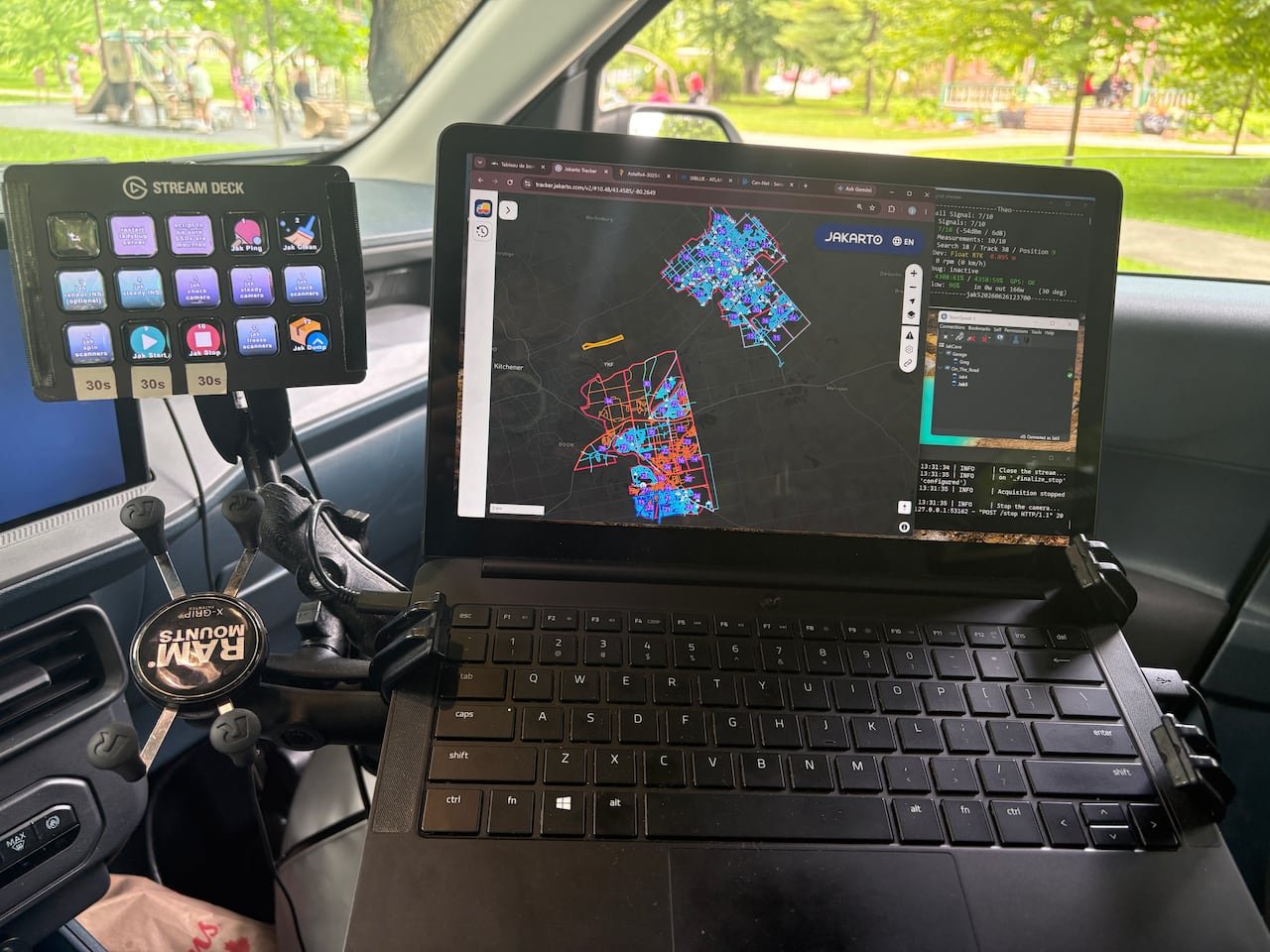
The vehicles are equipped with mobile LiDAR scanners that capture detailed measurements of trees, including height, trunk diameter, canopy size, and locations, as they traverse different neighborhoods. Additionally, the trucks gather data on infrastructure elements like signs and hydrants. The project is a collaboration with Jakarto, a Quebec-based mapping company.
Jakarto’s founder and CEO, Felix LaRoche, explained that their technology collects two million measurements per second while driving, enabling the creation of an extremely precise digital replica of the city. The scanning trucks operate solely on public roads, ensuring privacy by automatically blurring license plates before sharing the data with municipal authorities.
The collected data will facilitate identifying planting opportunities, enhancing long-term planning strategies, and pinpointing areas with insufficient tree canopy coverage. Guelph anticipates having an updated inventory and 3D virtual map of urban trees and public infrastructure within two months, a process that would have been significantly more time-consuming using traditional methods.
The digital map, referred to as a “digital twin,” replicates the city’s urban environment in a virtual, engineering-grade model. This tool will enable city staff to conduct measurements and inspect infrastructure remotely, streamlining asset management processes. LaRoche highlighted the potential benefits of this technology for various city departments.
Similar technology is being utilized in Cambridge for planning and development decisions. By combining aerial 3D mapping data with new street-level scans, Cambridge aims to create a more detailed virtual model to aid in visualizing proposed developments within the city. This enhanced digital twin is expected to be accessible to the public in the upcoming fall.
Guelph estimates the city currently hosts nearly three million trees and requires an additional 3.6 million trees to achieve the 40% tree canopy cover goal by 2070. Beaton expressed optimism that the collected data will expedite tree planting efforts, contributing to Guelph’s climate resilience in anticipation of future environmental challenges.

More like thisRelated
Tragic Hong Kong Fire Linked to Safety Violations

“Canada, India, Australia Form Tech Partnership at G20”
“Canada Defeats France 2-1, Tops Group D in FIFA U-17 World Cup”
“Alberta Teachers’ Strike Disrupts Student’s Routine”